[Link] Col de Banyuls to Pic Sallfort

2. [Link] Col de Banyuls to Pic Sallfort
Very hard
2h
3,2km
+634m
-19m
Embed this item to access it offline
A hike offering the chance to enjoy views on both sides of the border, the vegetation of the Albèra range, and a truly unique refuge.
Description
- At the Col de Banyuls (357m), take the trail climbing to the right. The path follows the border and starts behind the "Stèle des Évadés de France" memorial (357m).
- It ascends steeply to Pla de Les Eres (685m), passes by Pic d'Estella (Freedom Passage), and continues toward Pic Sailfort.
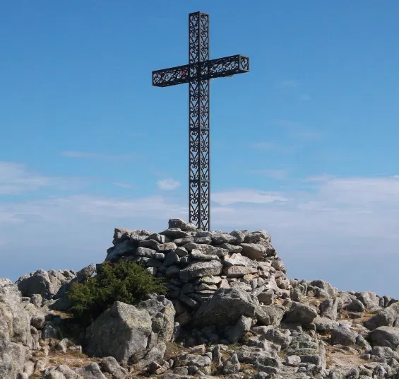
- Once on the ridges, head towards Pic Sailfort. You will pass a cross marking and then Tomy's refuge—please respect this place full of memories.
- Finally, reach the summit of Pic de Sailfort (983m).
- Departure : Col de Banyuls (357m)
- Arrival : Pic Sailfort (983m)
- Towns crossed : BANYULS SUR MER and ARGELES SUR MER
Altimetric profile
Recommandations
Let’s protect forest ecosystems to preserve our biodiversity!
Part of the route passes through the Massane Nature Reserve.
The Massane forest is a scientific research laboratory where nearly 6,500 species have been documented within an area of only 336 hectares.
Overuse of this space could cause irreversible damage to its habitat.
This site is therefore subject to rules and restrictions aimed at protecting its natural heritage.
The introduction or destruction of plants and animals, as well as any activities likely to harm the natural environment, are strictly prohibited.
The full list of restrictions for the Reserve is available by clicking here.
Plan ahead: bring water, a hat or cap, a windbreaker, snacks or a picnic, and sturdy shoes. Please respect the environment by taking your waste with you. Check the weather forecast before setting out.
Transport
Bus 1€
Access and parking
D914
Parking :
Col de Banyuls
