Néoulous summit - Col de l'Ouillat
LAROQUE DES ALBERES
Néoulous summit - Col de l'Ouillat
Hard
7h6
16,7km
+1227m
-1227m
Embed this item to access it offline
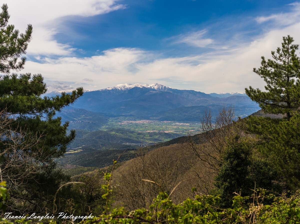
This hike offers spectacular panoramas on the Mediterranean coast to the East, the plain of Roussillon to the North, Catalonia to the South and Canigou to the West
2 points of interest
Aurelie Rubio  Peak
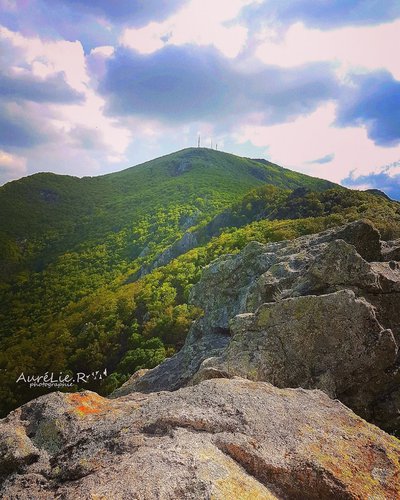
PeakPuig Neulos
Culminating at 1256 meters above sea level and marking the border between France and Spain, Puig Neulos is the highest point of the Massif des Albères. On this promontory, one is very quickly seized by the contrast of the stone tower, and the television relay station. The view is breathtaking. We can clearly see the Roussillon plain bordered by the sea, the Pyrenees mountain range to the west, and the Ampurda plain where the rocky coast comes to die gently in the Bay of Rosas.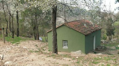
CCACVI  Refuge
Casot del Guarda
This summary hut is located 533 meters above sea level. With its concrete table and the opportunity to picnic outside, it will be a perfect resting place during your hike. It is possible to sleep on the large table or on one of the concrete benches. The nearby river can be useful as is the chimney in the refuge.
Description
Go to the church in the old village. Take the street that goes up in front of the gate of the church. This street turns into a path.
- Go up to a fork and go right. At the basin, continue straight along the irrigation canal until you hear the river below.
- At the fork, go left on the trail that climbs through the vegetation.At the next fork go right.
- New intersection : go left to reach the trail. Climb and take the path on the left after the old house in ruins At the next junction, continue on the left and at the fork take the path straight on. At the next fork go left.
- A little further, look at the dolmen «Balma del Moro» (50 meters) on the left. Continue the ascent to the Neoulous summit. The path leads to a forest trail. traverse and continue to climb on the path mountain path. Join a new forest trail.
- Follow it on the right for 600 meters.
- Take left on the path until the Néoulous summit (1256 mètres).
- The Albères summit is marked by « The Manel Tower», made of stone. Go down west following the GR10 on the ridge.
- On left, a barrier gives access to a snow well (200 meters). Go down to the Col de l’Ouillat.
- At the col, turn right on the asphalt road and continue until the fount « Reina de les Fonts ». Turn left on the path that descends rapidly under the beeches and chestnut trees. It crosses the track several times.
- Arriving about 450 meters above sea level, cross the river of laroque by a ford then 200 meters further pass next an ice well.
- Continue to descend and cross another ford.
- Arriving at the same fork that was taken at departure, continue straight on and return on the path in the opposite direction.
- Departure : Tourism office of Laroque des Albères
- Arrival : Tourism office of Laroque des Albères
- Towns crossed : LAROQUE DES ALBERES and SOREDE
Altimetric profile
Recommandations
You enjoy nature, You like it, take care of it...
Along the hiking trail, rubbish bins are at your disposal.
Every month over tens of thousands of hikers and walkers visit this exceptional site. Please do not litter and use the rubbish bins (glass, plastic, rubbish etc...). Also, please dispose of any litter you might find along the trail.
Help keep this site clean with simple yet essential gestures. Lets give back to nature what nature gave us.
Transport
Bus stop : Post office
Bus 2€
Bus 2€
Access and parking
Easy access, Take the direction of Laroque.
Parking :
Hikers' parking at the stadium