Col de l'Ouillat - Pic Néoulous

Col de l'Ouillat - Pic Néoulous
Medium
2h30
6,1km
+355m
-354m
Embed this item to access it offline
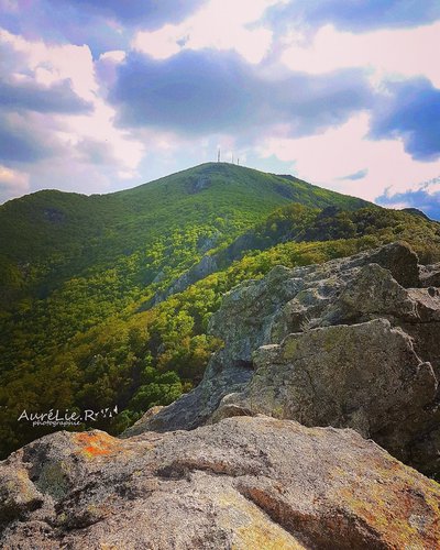
Discover the Albères State Forest and its stunning panoramas. On one side, you'll see the sea and the Roussillon plain; on the other, Catalonia and the Canigou.
1 point of interest

Aurelie Rubio  Peak
PeakPuig Neulos
Culminating at 1256 meters above sea level and marking the border between France and Spain, Puig Neulos is the highest point of the Massif des Albères. On this promontory, one is very quickly seized by the contrast of the stone tower, and the television relay station. The view is breathtaking. We can clearly see the Roussillon plain bordered by the sea, the Pyrenees mountain range to the west, and the Ampurda plain where the rocky coast comes to die gently in the Bay of Rosas.
Description
- From the chalet at Col de l'Ouillat, head left and take the small path on the right (yellow markers).
- Pass under the Roc Fuiros.
- At the base of Pic des Trois Termes, follow the border to the summit, Pic Neoulous.
- Then, descend to the left along the trail through the forest.
- At the hairpin turn, go left back to the starting point.
- Departure : Col de l'Ouillat
- Arrival : Col de l'Ouillat
- Towns crossed : LAROQUE DES ALBERES
Altimetric profile
Recommandations
Bring water, snacks or a picnic, a cap, a windbreaker, and good hiking shoes. Be mindful of the elevation gain and check the weather before you leave! Take your trash with you.
Access and parking
D900, D71b, D71, D71a
Parking :
Parking at Col de l'Ouillat
