From Banyuls to Pic Sallfort via the "GR10"
BANYULS SUR MER
From Banyuls to Pic Sallfort via the "GR10"
Hard
8h
19,4km
+1284m
-1283m
Embed this item to access it offline
1 point of interest
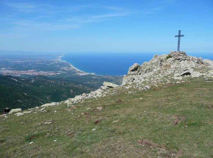
Col de Banyuls - François-Xavier Hallé 
Col de Banyuls-sur-Mer
This incredibly wild and unspoiled site, which serves as the border between France and Spain, has been the scene of many twists and turns in the history of refugees. Discover the beauty of the place and let yourself be amazed by the unique panorama of the site.
Description
- Depart from the Tourist Office, passing by the Town Hall and the café and restaurant terraces in the square, then onto Avenue du Puig del Mas. Take a glance across the street at the birthplace of the sculptor Aristide Maillol, marked by a plaque on the facade.
- Continue along Avenue du Puig del Mas for 150 meters. Turn right before the parking lot; the GR10 passes under the railway line.
- Turn right, the trail ascends, passing by a house to reach Col de las Vinyes, a junction of roads. The trail continues straight ahead, ascending to reach Col de Llagostera (255m). There's an orientation table; the building on the left is a former winery.
- Continue on the paved road for 500 meters, then turn right. The trail passes by the hunters' fountain and ascends steeply to Col des Gascons (386m).
- Leave the track that veers left and continue on the trail ascending towards Battery 500. The GR10 veers left to continue towards Col de Formigó and Col de la Vallauria (418m). Along the way, observe the Reig cellars (ruins).
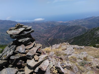
- From Col de la Vallauria, follow the GR10 to Sallfort (981m). There's an option to reach Col de Banyuls via the trail along the border (marked in yellow).
Note: This route can be shortened by starting from Col des Gascons, accessible via D86, also known as the Route des Crêtes.
- Departure : Tourist Office of Banyuls-sur-Mer
- Arrival : Tourist Office of Banyuls-sur-Mer
- Towns crossed : BANYULS SUR MER, PORT-VENDRES, COLLIOURE, and ARGELES SUR MER
Altimetric profile
Recommandations
Let's respect forest ecosystems to safeguard our biodiversity!
A portion of the route passes through the Massane Nature Reserve. The Massane forest serves as a scientific research laboratory, where nearly 6,500 species have been inventoried within a surface area of only 336 hectares. Overuse of this space can have irreversible effects on the habitat. Therefore, this site is subject to obligations and prohibitions aimed at protecting the natural heritage. The introduction or destruction of plants, animals, and any work likely to harm the natural environment is prohibited.
Follow the yellow and red markings. Remember to bring water, a hat or cap, hiking shoes, a windbreaker, or waterproof clothing outside of the summer months. Respect nature by carrying out your waste. Do not stray from the marked trails.
Transport
Access and parking
D914
Parking :
Free market car park (except on Thursdays and Sundays, market days) and Baillaury car park"