Path of the Mitg Pass
PORT-VENDRES
Path of the Mitg Pass
Easy
1h30
4,4km
+124m
-132m
Embed this item to access it offline
This hike is rich in diversity, offering the discovery of a fishing and commercial port, a stroll through the heart of the vineyard, and finally arriving at the site of Paulilles Cove along the coastal path.
Description
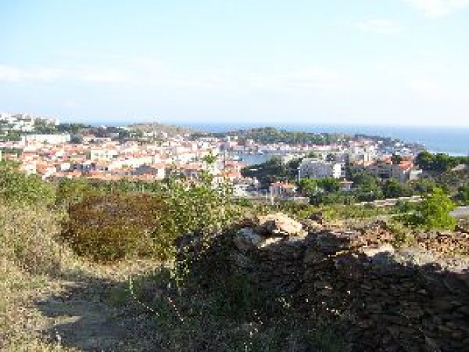
- From the Tourist Office, climb the steps to Place de la Castellane. Enjoy a beautiful view of the bay and the marina.
- Cross the square and take the Rue des Paquebots, continuing straight ahead via two sets of stairs. At the top, descend the Route Stratégique to reach the SNCF train station parking lot. Continue along the Gare road until the entrance to Val de Pintes, a public recreation area. Turn right, where Fort-Elme overlooks the ridge in front.
- To the left, pass through the tunnel under the railway tracks and join the D914. Cross the road and continue straight ahead.
- At this point, keep going straight (the housing estate is on the left).
- Continue straight ahead, then cross the Cosprons stream, and follow the Col de Pere Carmera.
- Pass under the SNCF bridge and follow the signs for Plage de Paulilles, walking alongside the parking lot.
- Follow signs to the "Maison du site" to visit the entire site of the former Nobel Dynamite Factory at Paulilles for free."
- Departure : Tourist office of Port-Vendres
- Arrival : Paulilles
- Towns crossed : PORT-VENDRES
Altimetric profile
Recommandations
Bring water, a cap or hat, and hiking shoes. Respect nature. Do not pick fruits.
Check the weather before setting off.
Check the weather before setting off.
Transport
Bus 1€
Access and parking
D614
Parking :
Parking of the Port-Vendres Tourist Office