[Walk] Discover the old village of Laroque and its surroundings

LAROQUE DES ALBERES
[Walk] Discover the old village of Laroque and its surroundings
Very easy
1h30
4,4km
+173m
-172m
Embed this item to access it offline
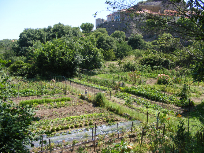
This family walk will allow you to explore the old village of Laroque-des-Albères and its immediate surroundings.
Attachments
- Downloadpdf
plaquette-enfants-2
Credit: plaquette - OT Laroque
- Downloadpdf
PLAQUETTE-PARENTS-2
Credit: Plaquette parents - OT Laroque
Description
- Starting Point: The Tourist Office.Climb towards the center of the old village using the small staircase next to the Tourist Office. Pass through the Placette de la Mairie, continue via Rue du Puig, and then Rue du 14 Juillet. Turn right onto Rue Maréchal Joffre.Place de la République: After the Côte de la Place, you'll reach this square, where you'll find a magnificent plane tree planted in 1830. Head toward Saint Félix Church, which was formerly an armory. Facing the church's porch, take Rue de l’Église, a cul-de-sac that transitions into a path bordered by a stream on the left. This path leads out of the village. Moulin de la Pave Ruins: On your right, you'll see the remains of this old flour mill, currently under restoration. Its origins date back to the 14th century, with operations lasting until the mid-19th century.A few meters ahead, discover the shaded Fontaine des Oiseaux. The path follows a partially buried canal.
- Climb back up to a junction and turn right. You’ll arrive near a reservoir. A few meters further, at a trail crossroads, take the left path towards Les Cabanes. Continue following the trail as it veers left, then right. *Mas d’en Bordes: You’ll arrive at this house located on the right. Pass alongside the house and continue along the trail.
- Leave the junction on your left and continue straight along the trail.*
Trail Intersection: When you reach a crossroads with signposts, ignore the trail on the left leading to Puig Neulos. Instead, take the trail on the right, which descends toward the river. Caution: This trail is heavily eroded in some sections, so proceed carefully. - At the trail junction above the river, turn left and follow the irrigation canal on your left to reach Les Caranques.*Les Caranques: A natural pool in the riverbed that, for generations, was a favorite swimming spot for local youth. Note: Swimming is now prohibited by a municipal decree for safety reasons.
Retrace your steps back to the main trail junction. From there, take the left path descending toward the river, signposted Roc del Grèvol.*River Crossing: Cross the river via a ford, then follow the trail as it ascends to reach a small paved road. - Go down this road (to the right) to reach the ruins of the Roca Vella Chapel a few meters further.This structure likely stood at a height of 9 meters.
Retrace your steps back to the trail junction. - Head to the left, following the irrigation canal on your right, to reach the trail descending to the Mineral Spring (look for a pole on the left marked with a "2").
- Take this small trail leading down to the Mineral Spring, where you'll arrive near the river with a picnic table. Caution: Do not cross the dam toward the Mineral Spring.
- Follow the River: Descend along the river via the yellow-marked trail and cross at the ford. Continue through a small wood until you reach a path on the left. Follow this path, and you will come to a small paved road.
- Descend this road (to the right). The Village Reappears: The first houses appear along Rue de Roca Vella, offering beautiful views of the village. Sant Sebastia Chapel: Visit this single-nave chapel with a trapezoidal apse and a semi-circular vaulted roof.
- Walk along the chapel’s wall and take Chemin de la Florentine, which leads you through gardens back to the old village. Cross a small footbridge over the river, and the path will join Rue du Château.
- Follow this street to the right.
- Before reaching the church, climb to the castle’s belvedere, first mentioned in 1100. From here, enjoy a stunning panorama: South: Pic Neulos (1,256 m)
West: Canigou Peak (2,784 m)
North: The Roussillon Plain
East: The Mediterranean Coastline - Descend again. After Côte de la Place, you’ll arrive at Avenue du Maréchal Joffre. At the intersection, look up to see the sundial. Turn left onto Rue Arago to return to the Tourist Office.
- Departure : Tourist Office of Laroque des Albères
- Arrival : Tourist Office of Laroque des Albères
- Towns crossed : LAROQUE DES ALBERES
Altimetric profile
Recommandations
Respect the basic safety instructions (adapted shoes, water, cap, hat, glasses, sunscreen), avoid straying from marked trails.
Some sections of the route are neither managed nor marked by the CC-ACVI. It is a municipal association that takes care of it.
Some sections of the route are neither managed nor marked by the CC-ACVI. It is a municipal association that takes care of it.
Transport
Bus 2€
Access and parking
D2, D618 et D11
Parking :
Hikers' parking at the stadium
