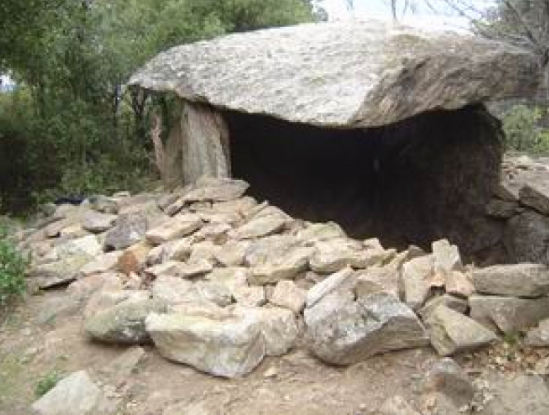
The "Balma del Moro" dolmen

LAROQUE DES ALBERES
The "Balma del Moro" dolmen
Medium
4h12
10,4km
+614m
-614m
Embed this item to access it offline
The goal of this hike is to discover "La Balma del Moro," one of the 60 dolmens in the Albères massif, meandering through the trails and the coolness of the undergrowth.
Description
- From the Tourist Office – Hiking Center, head to the Church and the center of the village.
- Facing the church gate, take Church Street, a dead-end, followed by the trail, limited on the left by a stream. The trail exits the village. On the right, Moulin de la Pave (old mill), and a few meters higher, a lovely shaded fountain. Fontaine des Oiseaux. The trail follows a partially buried pipeline. At the junction, turn right. Here, a small water reservoir, a trail intersection, and informative signs.
- Take the direction DOLMEN – PIC NEULOS – COL DE L'ULLAT. On the left side of the trail, follow a small irrigation canal until you reach a strategic trail junction.
- Take the left trail. Notice a blue and white wooden marker. The path climbs through the vegetation. Intersection. Continue the path that ascends to the right, following the yellow markings. Another trail intersection. Take the left trail.
- The trail opens onto a track. Ascend this track to the right. After about 200 meters, the ruin of an old farmhouse appears on your left.
- After this ruin, leave the track for a trail on the left. Trail intersection. Turn left. A little further on, the trail runs along a fence. It becomes very rutted.
- Trail crossing. On the right, a metal fence and gate. On the left, a path (yellow cross). Go straight, taking the trail in front. The trail climbs steeply under a chestnut grove. Intersection and signs. Take the left trail that ascends.
- A few meters further, take the fork that leads to the dolmen "La Balma del Moro," located on the ridge. Behind the dolmen, a small path allows you to reach a beautiful viewpoint. Return to the path. Leave the trail on the left and descend to the right. At the next intersection (sign + cairn), take the trail that goes left and descends gently into the forest. It crosses a first ravine where Fontaine Galdriq is located, progresses along the slope, and changes valleys. The trail reaches an old track overgrown with vegetation and heads towards the river "Correc de les Teixoneres."
- Cross the river and continue on the path above which is the fountain of En Pep. Trail fork.
- Take the left path, which joins a wide forest track. Descend it to the right.
- The track crosses the Correc de les Teixoneres via a ford. Continue to descend towards the plain. Intersection with the track that leads to the "Parraguères." Continue to descend on the left track. After a bend, the ruin of the old farmhouse encountered at the beginning appears on your right.
- Find the same route as on the way there. 200 meters later, leave the track and take a path on the left that descends into the vegetation. Trail intersection. Continue descending to the right. New intersection. Continue the descent on the left trail. Trail junction. Continue descending towards the village, following the route taken at the start of the hike to reach the Tourist Office.
- Departure : Laroque des Albères Tourist Office.
- Arrival : Laroque des Albères Tourist Office.
- Towns crossed : LAROQUE DES ALBERES
Altimetric profile
Recommandations
Bring water, a cap, and a windbreaker. Check the weather before departure. Carry your waste back.
Transport
Access and parking
D618, D50
Parking :
Hikers' parking at the stadium
