Between sea and mountain
PORT-VENDRES
Between sea and mountain
Medium
4h
12,9km
+0m
0m
Embed this item to access it offline
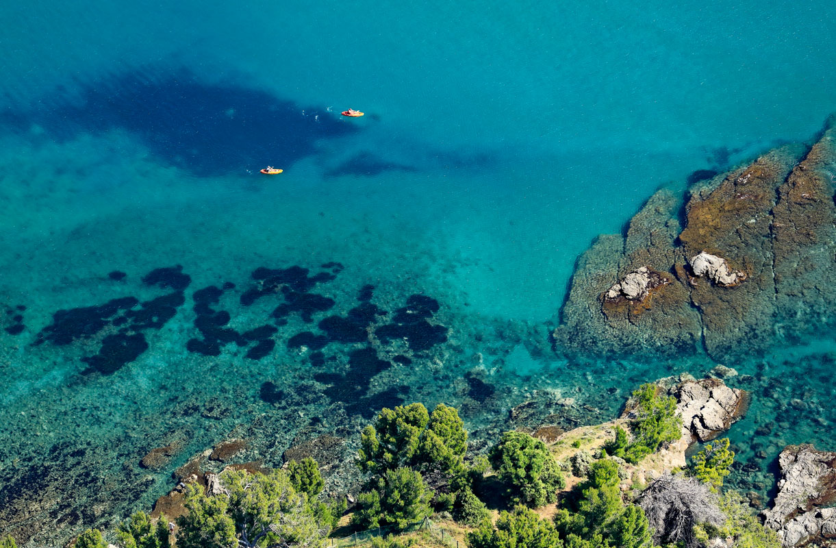
Hike 'Mar i Munt' (sea and mountain), offering exceptional viewpoints and allowing you to discover Port-Vendres and its surrounding treasures. As a bonus, one of the most beautiful beaches in the region!
1 point of interest
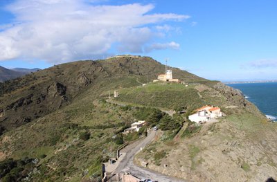
Le Sémaphore sur fond de Fort Béar - CCACVI  Cultural heritage
Fort Béar
Built between 1877 and 1880, Fort Béar was built in order to lock the borders and replace the fortifications of Vauban with buried polygonal forts. This fort was used until the middle of the 20th century, when a radio station was installed after the German occupation (1949). He is now owned by the Army.
Description
Starting point: Port-Vendres Tourist Office. Head towards the Jetty, following the coastal path signs around the port.
- When you reach the Jetty Cove, turn right onto the path that ascends towards Fort Béar. After passing through the rocky pass, continue on the path until you reach the vineyard trail.
- Turn left onto the trail.
- Continue until you reach Bernadi Beach, cross it, and head towards the second beach (Paulilles Beach).
- At the far end of the beach, turn right, pass under a small bridge, and cross the Paulilles site (not marked until you reach the Paulilles parking lot). Pass through the tunnel, follow the parking lot, and take a small path on the left. Pass under the bridge and turn right. After 300 meters, take the Col del Mitg path, which leads up to D86a and the village of Cosprons.
- Turn right (over the bridge) towards Coll de Perdiguer.
- Take the muleteer’s path.
- Turn right and then descend to the left.
- Continue straight ahead.
- Cross the tunnel and continue towards the train station.
- After the station, turn left onto the Route Stratégique towards the town center, cross Place de la Castellane, go down the stairs, and arrive back at the Tourist Office.
- Departure : Tourist office of Port-Vendres
- Arrival : Tourist Office of Port-Vendres
- Towns crossed : PORT-VENDRES
Recommandations
Make sure to bring plenty of water, hiking shoes, and a cap or hat.
Transport
Access and parking
D914, D114, D86, D86b
Parking :
Parking of the Tourist Office