The "Bonnevie" Path

CERBERE
The "Bonnevie" Path
Easy
2h
6,7km
+321m
-321m
Embed this item to access it offline
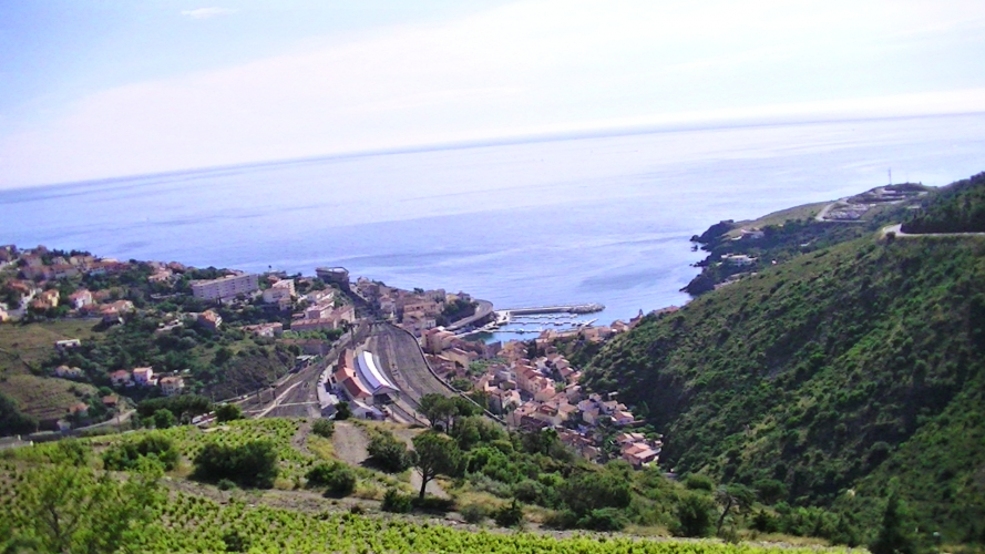
A short hike above Cerbère between vineyard and "mas" (old stone house).
2 points of interest

Gilles Athier  Small patrimony
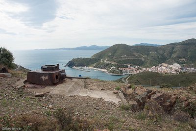
Turret of "Le Col des Belitres"
Turret dating from the Second World War. Constituent element of the Mediterranean fortified front made by German forces in 1942 in response to the landing in North Africa which forces the German forces to occupy the free zone.
Placette des transbordeuses à Cerbère - Elisabeth coste  Small patrimony
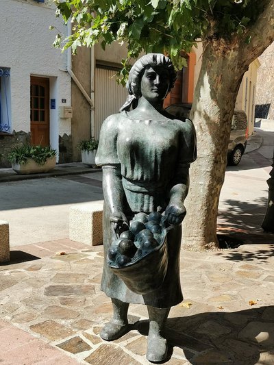
La placette des transbordeuses
This woman, wearing a "couffe" (a traditional headscarf, derived from the word "couffin" meaning basket), is a transbordeuse of oranges. Oranges were the main product imported from Spain to France because of their low production cost. Upon arrival, the oranges had to be transferred from one train car to another due to the difference in rail gauge between Spanish and French tracks. Transbordage (transshipment) was required for all types of goods, and similarly, passengers had to change trains and stop at Cerbère. Even the Amar Circus made a stop in Cerbère, delighting children who were able to see the elephants!
There were five teams of transbordeuses, each consisting of five women employed by freight forwarders (transitaires). Although the job was physically demanding, it also had its moments of camaraderie, as the women would work together and enjoy some social interaction, escaping the monotony of everyday life.
However, by 1903, the transbordeuses demanded a 25 sous wage increase because they were working without contracts, facing job insecurity, and being called to work at any hour. They were poorly paid for their hard labor (unloading wagons weighing between 7 and 17 tons) and were compensated with vouchers, which they could only exchange for money on Sundays. Despite promises made by the transitaires, the women received nothing.
In 1906, Cerbère became the site of France's first women's strike, in the midst of a broader climate of social protests and demands for workers' rights. This historic strike marked a key moment in the fight for better working conditions and pay for women in the labor force.
Description
- From the Tourist Office of Cerbère turn to the right avenue Maréchal Joffre, take the first street on the right to join rue du Riberal and leave to the left. At the level of "transbordeuses" square, go to the right and cross the old railway track.
- Stay right along the river. At the bridge turn left, you will pass "Mas Mingou" and "Mas Tounet".
- Turn right on the river and follow the path.
- At this point go left on the path (DFCI-AL66) then the path (DFCI-AL66bis) for 2km.
- Arriving on the D914, make a few meters on the left, the old border post is located in front of you. Go back down towards the village of Cerbère.
- Cross the railway tracks and reach the "Transbordeuses" square. Return to the Tourist Office by the same route as going.
- Departure : Tourist Office of Cerbère
- Arrival : Tourist Office of Cerbère
- Towns crossed : CERBERE
Altimetric profile
Recommandations
Bring water, cap and good shoes.
Take your trash with you.
Take your trash with you.
Transport
Access and parking
Access by RD 914
