
Madeloc Massif
COLLIOURE
Madeloc Massif
Hard
6h30
16,3km
+963m
-962m
Embed this item to access it offline
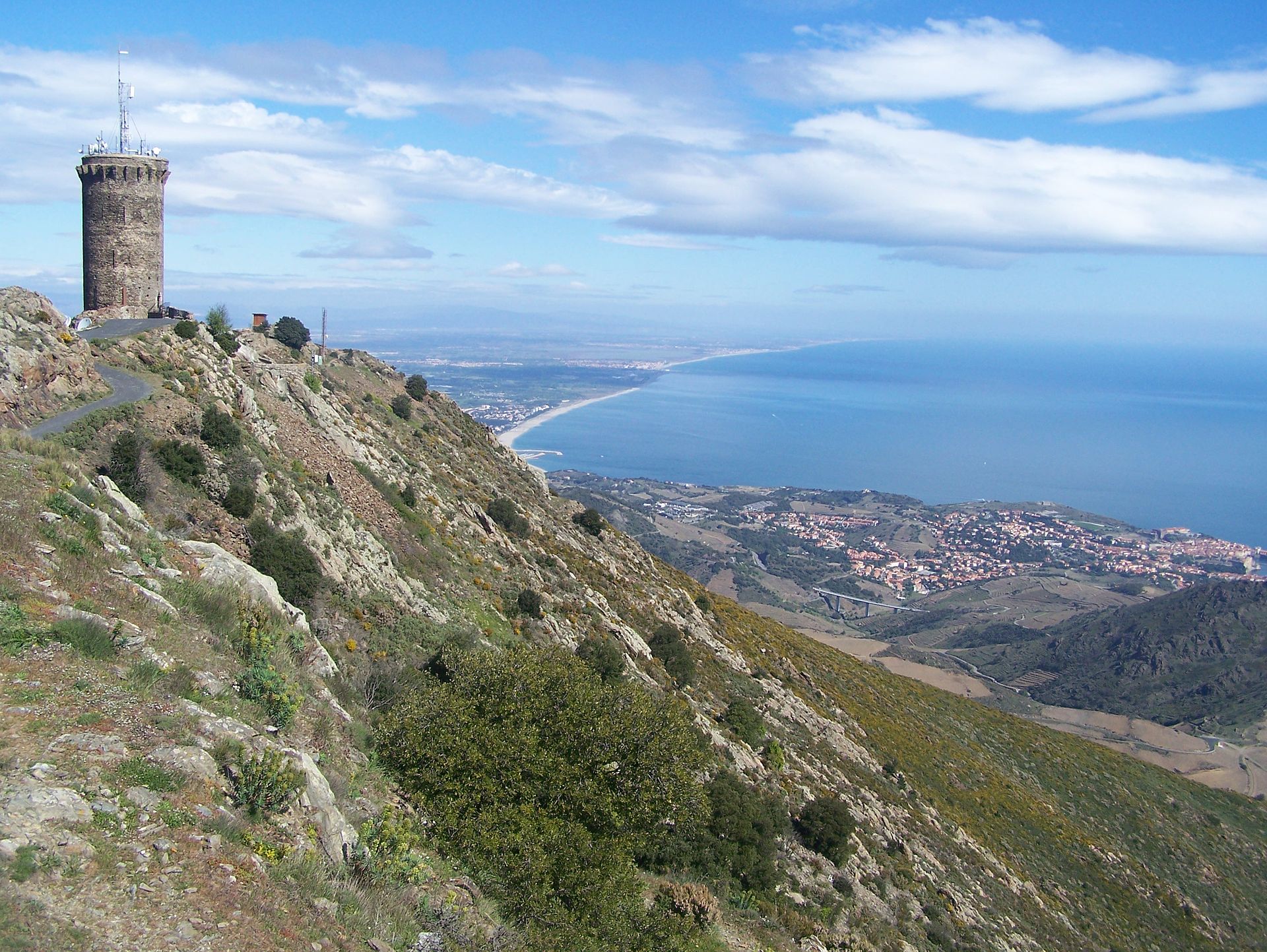
From the Château de Collioure, the path ascends through the vineyards. After passing the chapel of Notre-Dame-de-Consolation, the route climbs up to the ridges of the Tour de la Madeloc. From the top, the view is breathtaking, showcasing the Côte Vermeille and the three stunning villages of Collioure, Port-Vendres, and Banyuls.
2 points of interest

CCACVI  Cultural heritage
Ermitage Notre Dame de Consolation
The Hermitage of Our Lady of Consolation dates, according to the oldest writings, to 1496. According to some, the building was built on an old site of pagan worship. Numerous hermitages line the Massif des Albères testifying to the rise of these buildings during the 17th century. This hermitage is also very nice to take a break along your hike. In the shade of the trees, you will be able to take advantage of the place to have a picnic in complete tranquility.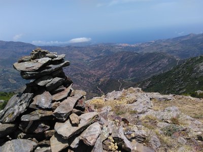
Col de Banyuls - François-Xavier Hallé 
Col de Banyuls-sur-Mer
This incredibly wild and unspoiled site, which serves as the border between France and Spain, has been the scene of many twists and turns in the history of refugees. Discover the beauty of the place and let yourself be amazed by the unique panorama of the site.
Description
- Leave the seafront by heading up Avenue Camille Pelletan, then turn left onto Rue de la République and proceed to the roundabout. Cross the road and ascend in front of the church (Rue du Temple). Pass under the railway bridge, continue on Rue de la Galère to the Chemin de Consolation junction, and turn left to leave the village.
- Pass under the viaduct and continue straight toward the Oratory of Sainte-Thérèse. Take the path to the left at the small bridge.
- Follow the wide cobblestone path leading to Consolation. Continue along the path and then take the stairs carved into the rock on the left to reach the hermitage. You can stop for refreshments at the Notre-Dame de Consolation Hermitage. Beyond this point, the trail skirts a fenced vineyard and continues through the garrigue. The path becomes steeper as it ascends to the RD 86 and the Col de la Serre. Starting from this point is also an option.
- At Col de la Serre, leave the road and climb the path on the left. On reaching the Mas de la Serra, continue on the left-hand trail and ascend a steep slope toward the Batterie de Taillefer. Starting from this point (Col de la Serre) is also possible.
- Descend toward the Col de Taillefer and follow the trail straight ahead. After several bends, you’ll reach the Tour de la Madeloc. Enjoy the exceptional panoramic views of the Côte Vermeille, the Tour de la Massane, and the Roussillon Plain.
- Descend via a small road to the Batterie des 500 and take the rocky trail opposite, which connects to the GR 10 on the right. Avoid heading toward the Col des Gascons.
- Ignore the path on the left and continue to the right toward the Col de Vallauria, circling the Massif de Madeloc via the Col de Formingo and Vallauria. Several ruins are visible along the route.
- At the junction, take the path on the right for 50 meters, then continue right, keeping the Tour de la Madeloc in sight. Follow this trail along the hillside, avoiding the path leading to Col de Taillefer.
- Retrace your steps along the same path you took earlier.
- Departure : Tourist Office of Collioure
- Arrival : Tourist Office of Collioure
- Towns crossed : COLLIOURE, PORT-VENDRES, BANYULS SUR MER, and ARGELES SUR MER
Altimetric profile
Recommandations
Bring plenty of water, sturdy walking shoes, a windbreaker, and a hat.
Do not leave litter in nature.
Check the weather before setting out.
Respect the work of local farmers.
Avoid ascending to the tower in strong winds.
Do not leave litter in nature.
Check the weather before setting out.
Respect the work of local farmers.
Avoid ascending to the tower in strong winds.
Transport
Bus 1€
Access and parking
D914, D114
Parking :
Glacis Parking